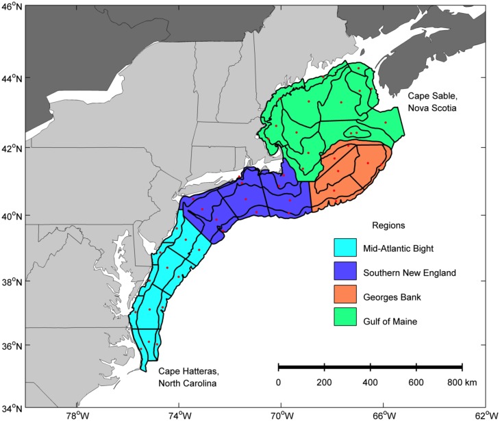
Fig 1. Sample strata and regions of the Northeast U.S. Shelf Ecosystem.
Bottom trawl and ichthyoplankton surveys have been conducted over the past 40 years in the NEUS Shelf. Station data were grouped spatially based on the current 47 Ecosystem Monitoring strata (black polygons). The center points of each of the 47 strata (red dots) were used to estimate the distance (km) north of Cape Hatteras, North Carolina and the distance from the 200-m isobath. The strata were grouped into four regions of the shelf with similar hydrographic characteristics: Mid-Atlantic Bight (cyan), Southern New England (blue), Georges Bank (orange), and Gulf of Maine (green).

