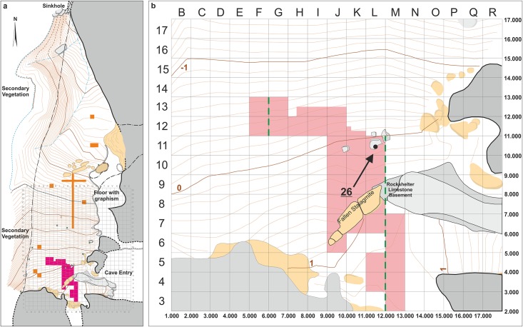
Fig 3. Plan of Lapa do Santo.
a) The grid corresponds to 1 square meter units. Purple and orange areas indicate excavated surfaces. Pink area indicates the main excavation area (MEA). The bedrock is depicted in gray, and secondary deposits such as breccia and stalagmites in beige. The topographic lines are 10 cm equidistant and the associated values correspond to the z-value of the site coordinate system. b) Detail of the MEA area. Black disk and the black arrow indicate the position of Burial 26. Numbers in the lower and right margin indicate the x and y values, respectively, from the coordinate system of site.

