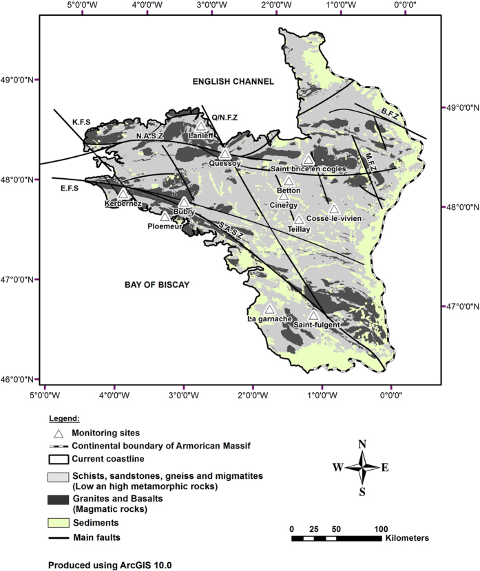
Figure 1. Location map of the sampling sites and geology of the Armorican Massif.
Twelve sites showing high Cl concentration were chosen from the ADES national groundwater monitoring database. The well characteristics are presented in the Table S1. Two scientific monitoring sites (Kerbernez—Agrhys observatory and St Brice en Coglès) presenting shallow modern groundwater were also included to get a representative modern end-member. Three main geological domains are separated by large shear zones (South and North Armorican Shear Zones) and divided by more recent N140° fault zones (Elorn, Kerforne, Quessoy/Nort). The geological shapes have been manually created from detailed geological maps available on-line from BRGM (http://infoterre.brgm.fr). The coast line has been manually pointed as well as the sampling sites which have been pointed from their GPS coordinates.

