
Figure 2.
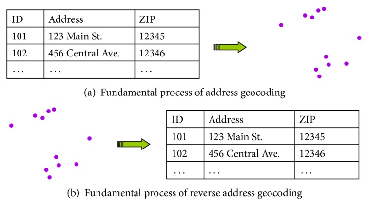
Geocoding and reverse geocoding. Geocoding (a) is the process of assigning locations (i.e., coordinates) to address information. A tabular dataset of addresses becomes a map. Reverse geocoding (b) literally puts this in reverse and converts mapped locations to addresses. Errors in the geocoding and reverse geocoding process may result in mismatched address information; that is, the addresses obtained using reverse geocoding may not be identical to those used in the original geocoding.