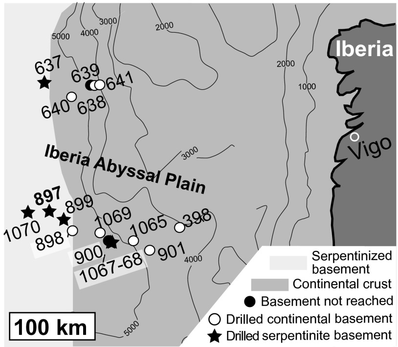
Fig. 1.
Simplified geological map of the Iberia Margin showing the localities of drill sites from Ocean Drilling Program Legs 103, 149, and 173. Samples analyzed in this study are from Site 897. Interpretation of geological units is based on drilling results and geophysical surveys (drill site locations and geological interpretation from ref. 60).

