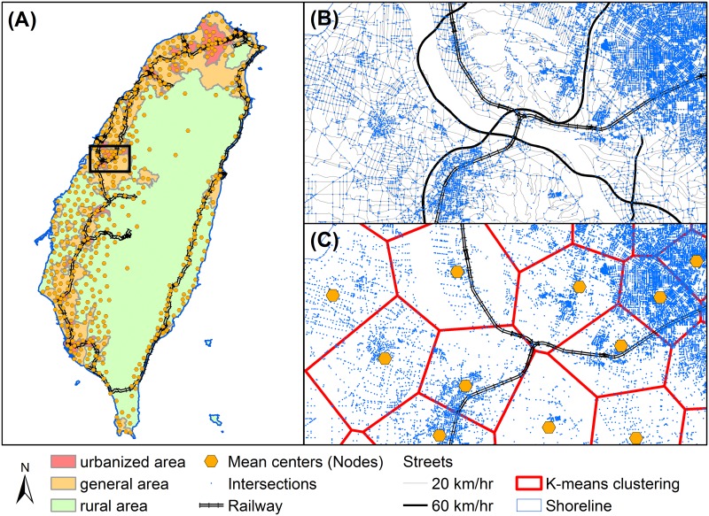
Fig 3. Transformation from transportation system to geospatial network.
Spatial distribution of (A) national-scale population centers and urbanization status, (B) junctions of the streets, and (C) the centroid nodes where people gathering together. Data souce: Institute of Transportation, MOTC (Taiwan).

