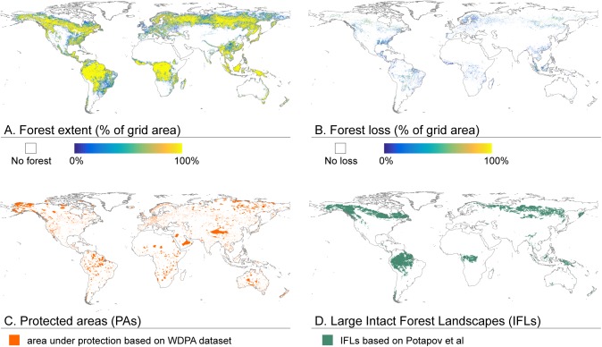
Fig 1. Aggregated (A-B) and converted (C-D) datasets used for the forest loss analyses.
A) Forest extent in percentage of grid area at 1 km resolution, based on Global Forest Change (GFC) data [5]; B) Forest loss in percentage of grid area at 1 km resolution, based on GCF data [5]; C) Protected areas based on World Database of Protected Areas (WDPA) [30], converted to 1 km resolution; and D) Large Intact Forest Landscapes (IFLs) based on dataset by Potapov et al [20], converted to 1 km resolution.

