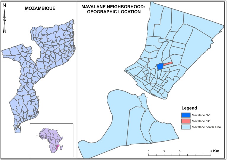
Fig 1. Geographical representation of study area.
Left panel shows the geographical localization of Mozambique in south east Africa (Mozambique is highlighted in pink) and map of Mozambique. Right panel is the representation of the neighborhood of Mavalane health area covered by the Mavalane health center. Mavalane health area comprises two geographical and well delimited areas, namely, Mavalane “A” (dark blue) and Mavalane “B” (pink) neighborhood.

