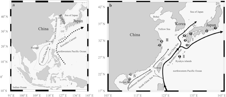
Figure 1. The sampling sites of P. modestus and oceanographic conditions in the China seas during the glacial53,54 (a) and contemporary39,40 (b) periods.

Two glacial sea basins (Okinawa Trough (OT) and South China Sea) were isolated by the exposure of the Taiwan Strait and the Taiwan-Ryukyu land bridge (TWRLB). The glacial shoreline and ocean current are denoted by the light solid line and dotted arrows, respectively. The contemporary surface circulations, including the summer Southwest Monsoon Current, the Taiwan Warm Current (TWC), and the main course of the Kuroshio Current and Tsushima Current (TC), are shown by solid arrows. The names of the numbered sampling localities and four geographic groups (I, II, III and IV) corresponding to different regions are listed in Table 1. The map was created in the Generic Mapping Tools (GMT v5.1.2; http://gmt.soest.hawaii.edu/) software package.
