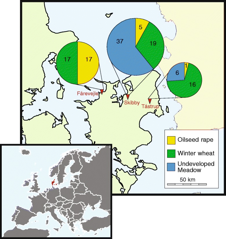
Fig. 1.

Map depicting geographical location of the three sampled localities at the island of Zealand, Denmark. Map of Europe is inserted. At each locality, three fields were sampled for 50 root systems and associated soil of each of the respective crops, i.e. oilseed rape, winter wheat and uncultivated pasture. Inserted pie charts indicate number of Metarhizium flavoviride isolates obtained from each field. Areas of pie charts indicate relative contribution of each locality to the total number of isolates characterized. Maps were created from free maps available at d-maps.com (http://d-maps.com/carte.php?num_car=2233&lang=en and http://d-maps.com/carte.php?num_car=5116&lang=en)
