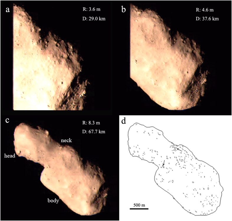
Figure 1. Outbound images display boulders on the surface of Toutatis (from (a–c)).
The left side of Toutatis is sheltered by the solar panel (a,b), whereas c is the first panoramic image acquired by Chang’e-2. The resolution (R) and imaging distance (D) are shown. The Sun-Toutatis-Chang’e-2 phase angle for outbound imaging is ~6.4°. (d) The sketch map shows the outline of Toutatis, and the approximate positions of 222 boulders identified in this work. The two largest boulders with geometric mean sizes larger than 50 m are marked by black arrows around the neck region.

