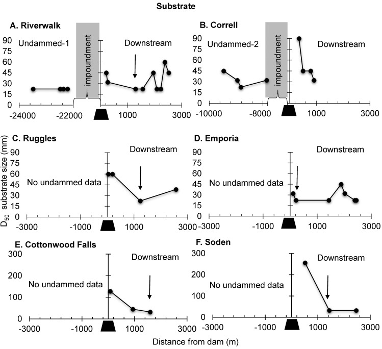
Fig 6. Substrate size.
Longitudinal profiles of substrate size for the six dams in the study reach showing upstream undammed sites as available (left) and downstream (right) samples (black trapezoid). Each point represents a riffle’s location in relation to its distance from the dam. The end of the dam footprint is indicated by an arrow, where applicable, and was considered to be where riffles reached a baseline determined by the undammed sites, or the minimum value for (D50) on its river (Upper Neosho or Lower Cottonwood). (A) Riverwalk, (B) Correll, (C) Ruggles, (D) Emporia, (E) Cottonwood Falls, and (F) Soden. The longitudinal profile for the two reference sites, Undammed-1 and Undammed-2 are plotted in the upstream panel for their corresponding dam sites, Riverwalk and Correll, respectively.

