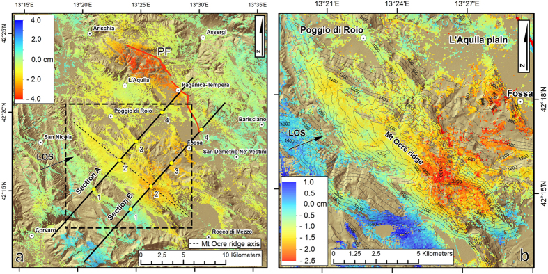
Figure 3.
(a) Line-of-sight postseismic displacement map from the InSAR CSK dataset for the time interval between April 12, 2009 and August 6, 2010. (b) Detail of the postseismic displacement affecting the Mt Ocre ridge area (black box in Fig. 3a). Maps were created with ArcGIS and Adobe Illustrator software.

