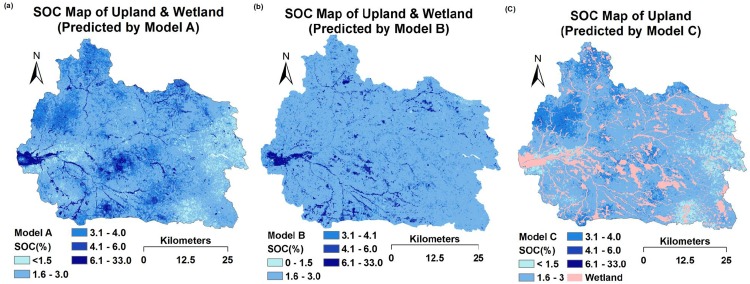
Fig 6. Prediction maps (30-m resolution) of topsoil organic carbon (SOC) using the Cubist model.
(a) Map for upland and wetland, predicted by Model A based on ancillary environmental data, remote sensing data and the estimated spectrum (1930 nm). (b) Map for upland and wetland, predicted by Model B based on ancillary environmental data and remote sensing data. (c) Map for upland, predicted by Model C based on ancillary environmental data, remote sensing data and the estimated spectrum (1930 nm).

