Figure 1.

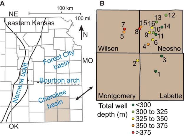
Map showing (A) major structures in eastern Kansas and (B) locations and depths of coalbed methane wells sampled in the Cherokee basin.

Map showing (A) major structures in eastern Kansas and (B) locations and depths of coalbed methane wells sampled in the Cherokee basin.