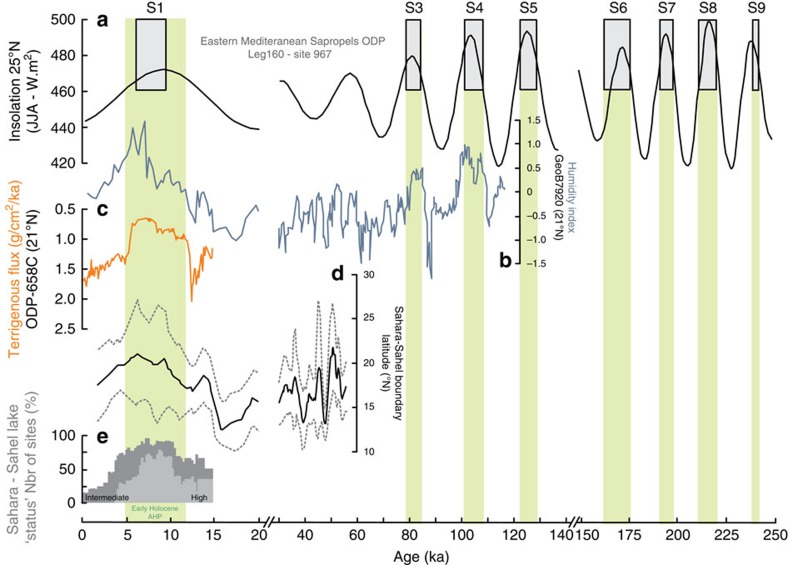
Figure 2. Compilation of North Africa paleoclimate records for the last known period of activity of the Timiris Canyon.
(a) Sapropels record from core ODP Leg 160 (site 967, Eastern Mediterranean Sea)38 together with summer insolation (June, July and August) at 25 °N (ref. 39). The AHPs—identified using the sapropels1 (except for the early Holocene AHP)—are highlighted in green. (b) Continental humidity index from grain-size measurements of core GeoB7920 (ref. 11; 20.75 °N;18.58 °W), (c) Terrigenous Flux6 of ODP658 site (20.75 °N; 18.58 °W), (d) the estimated latitudinal position of the sedimentary Sahara–Sahel boundary24 (black line) with its uncertainty (grey dashed lines). (e) Lake level status in East and North African basins25.

