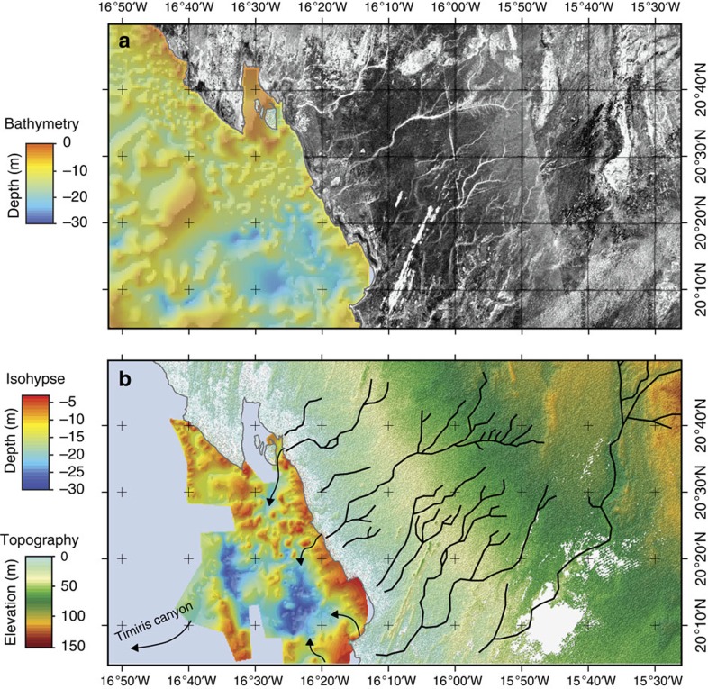
Figure 3. Coastal section of the Tamanrasett paleoriver.
(a) PALSAR radar observation of the coastal part of the Mauritania. The scale of grey corresponds to the back-scattering power. (b) Coastal part of the Tamanrasett paleodrainage (black) identified in the PALSAR image. Isohypse map of the bedrock roof showing the presence of paleovalleys (arrows) of the Arguin Basin22.

