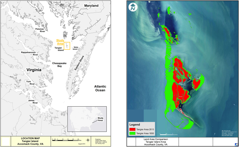
Figure 1. Location and configuration of the Tangier Islands, in Virginia waters of Chesapeake Bay, USA.
Map created using ESRI ArcGIS, ArcMap 10.1. Source: Esri, DigitalGlobe, GeoEye, Earthstar Geographics, CNES/Airbus DS, USDA, AEX, Getmapping, Aerogrid, IGN, IGP, swisstopo, and the GIS User Community. For more information on this map, including the terms of use, visit: http://goto.arcgisonline.com/maps/World_Imagery.

