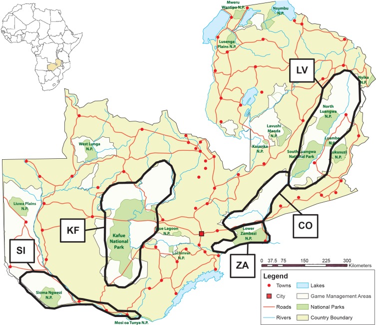
Fig 1. Map of Zambia showing the five main areas sampled: LV (Luangwa Valley); CO (Corridor); ZA (Lower Zambezi); KF (Kafue); and SI (Sioma Ngwezi).
Eastern region consists of LV, CO and ZA. Western region consists of KF and SI. More detailed location information for each sample is available in S1 Table.

