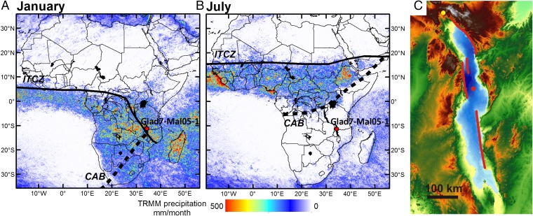
Fig. 1.
(A and B) Continental TRMM 2B31 [combined TRMM microwave imager (TMI) and precipitation radar (PR)] precipitation estimates from 1998 to 2009 for January and July (SI Appendix) across Africa. Drill site 1 from the Lake Malawi Drilling Project and the interpreted ITCZ and CAB are labeled. (C) Bathymetric map of Lake Malawi (maximum water depths of north and central basin are ∼600 and ∼700 m, respectively), with digital elevation model of the region surrounding the lake. The lake surface elevation is 474 m, and maximum relief on map is ∼2,600 m. Red circle is central basin drill site. Yellow circle is location of Rungwe volcanoes, the presumptive source of the tephras dated in the core. Main border faults, which accommodate most of the basin subsidence, are shown in red.

