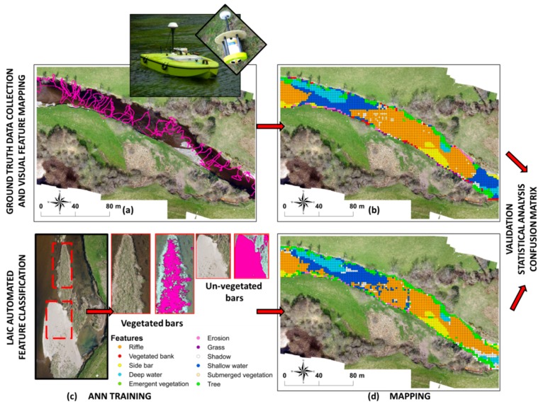
Figure 3.
Detailed diagram of the workflow for the Leaf Area Index Calculation (LAIC) image classification and validation based on [18] (a–d). (a) 300 m section within the reach showing the ADCP measurements obtained along with a detailed image of the radio control boat and ADCP sensor used; (b) Map showing the hydromorphological features obtained from visual identification on a 2 m × 2 m regular grid; (c) Examples of sections selected for and outputs obtained from the Artificial Neural Network (ANN) training; (d) Map showing the hydromorphological feature classification obtained with ANN on a 2 m × 2 m regular grid.

