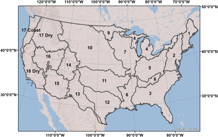
Fig. S1.
USGS two-digit HUC regions used for analysis of both aquatic carbon and terrestrial carbon balance. HUCs 17 and 18 have been modified as identified in SI Materials and Methods to represent differences in precipitation regimes across the Coastal and Cascade mountain ranges.

