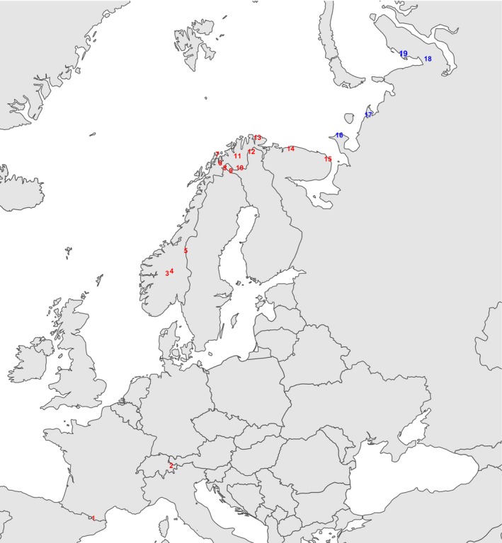
Figure 2.

The locations of the 19 sites from which sample plot data were used in the analysis of tundra vegetation patterns. The Pyrenees (1), The Alps (2), southern Scandes (3–5), northern Scandes (6–9), interior Finnmark and northern Finnish Lapland (10,11), coastal Finnmark (13), Kola Peninsula (14,15), Kanin Peninsula (16), Pechora Peninsula (17), and Yamal Peninsula (18,19). The arctic sites (Walker et al. 2005) are shown in blue, other treeless tundra sites are shown in red.
