
Figure 6.
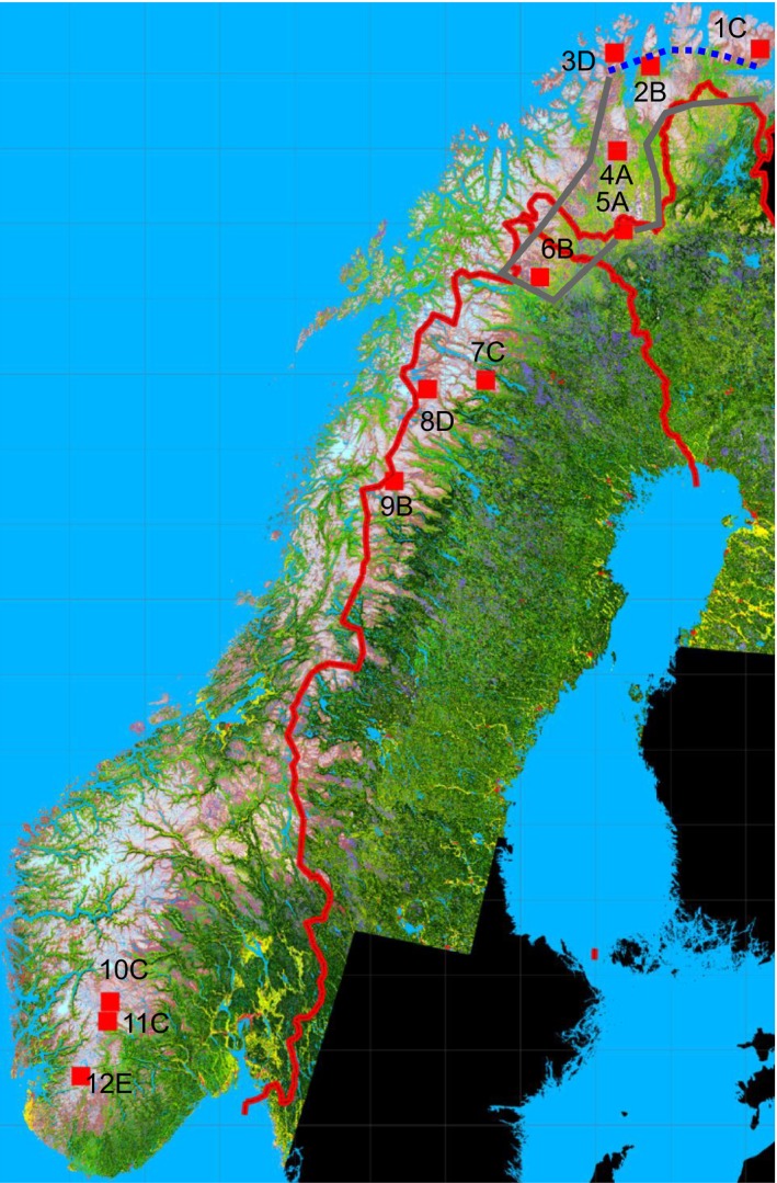
Distribution of tundra (purple‐white), mountain birch forest (bright green), and coniferous forest (dark green) in northern and western Fennoscandia excluding Russian territory. The deep purple represents dwarf birch heaths. The red squares and numbers refer to the locations of the twelve 25 × 25 km quadrats for which habitat distribution was computed from classified satellite images and winter temperatures were assessed by the satellite‐based method. The capital letters refer to the clusters to which the areas were divided on the basis of their habitat distributions. The thick gray line limits the area where the evidence presented by us indicates that the tundra can be regarded as arctic without the oro‐prefix. The dashed blue line denotes the approximate limit of the maximally oceanic sector of the Fennoscandian arctic, which, with respect to ecological conditions and vegetation, is more similar to the Scandinavian ericoid‐graminoid than to the East European dwarf birch tundra, which prevails in the inland. Simplified from the original vegetation map of B. Johansen (unpublished).