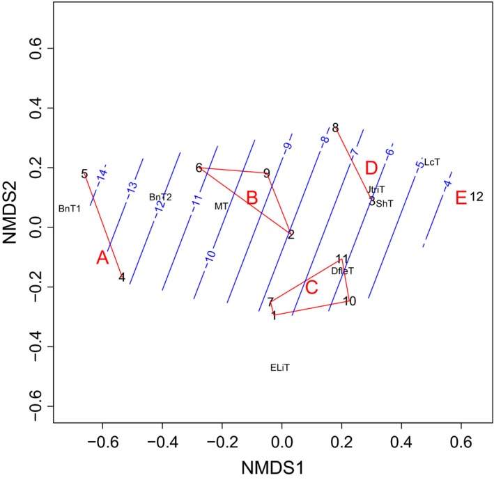
Figure 7.

Ordination of the Fennoscandian tundra areas used in the satellite‐based climate and vegetation studies on the basis of abundance relationships between different types of heath vegetation, including snowbeds. Red lines combine five clusters (A–E) based on a complete linkage cluster analysis. The fitted trend surface indicates the winter temperature (January–February °C) gradient (blue lines). The black numbers refer to the twelve 25 × 25 km quadrats shown in Figure 6. The vegetation types: ShT = Salix herbacea type = dwarf willow snowbed; DfleT = Deschampsia flexuosa type = moist, grassy snowbed; JtriT = Juncus trifidus type = grassy, dry snowbed; MT = Myrtillus type = bilberry‐purple heather heath, BnT = Betula nana type = dwarf birch heath (BnT1: with continuous lichen cover, BnT2: with scanty lichen cover or moss‐dominated bottom layer); ELiT = Empetrum lichens type = ridge heath with continuous vegetation; LcT = Luzula arcuata ssp. confusa type = ridge heath with discontinuous vegetation.
