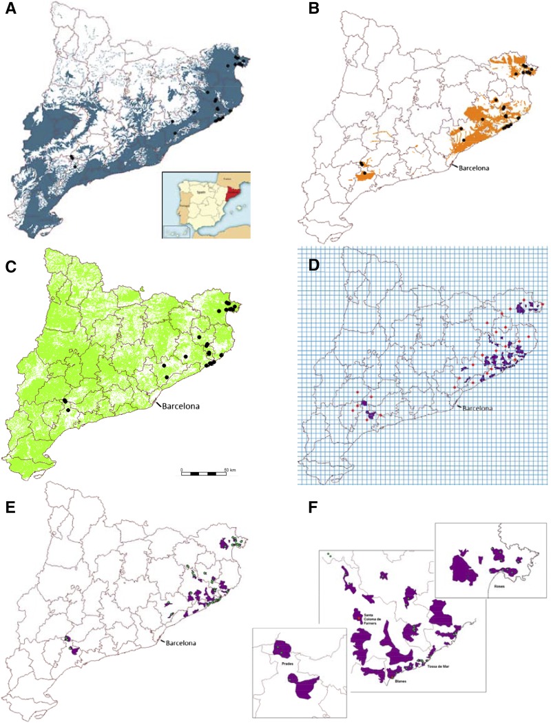
Figure 1.
Maps showing the Arabidopsis distribution model in northeastern Catalonia, Spain. Known locations of Arabidopsis (black circles) overlaid upon a binary map of alimetry (A; 0, white; and 1, blue [0–950 m]), geology (B; 0, white; and 1, orange [granite, granitoid, granodiorite, and hornfels]), and land uses (C; 0, white; and 1, green [sandy, soil with sparse vegetation, rain-fed fruit trees, thickets and meadows, sclerophyllous forest, and residential areas]). D, Areas predicted to contain Arabidopsis (purple polygons) obtained from the interception of the maps in A to C, and a 5- × 5-km grid is used to select random points (red points) outside the prediction locations of Arabidopsis. E, Map of potential geographic distribution of Arabidopsis (purple polygons) and confirmed populations (green points). F, Zoom of the main areas of interest from E, including the two sites chosen for reciprocal transplant experiments at Blanes and Santa Coloma de Farners (red points).

