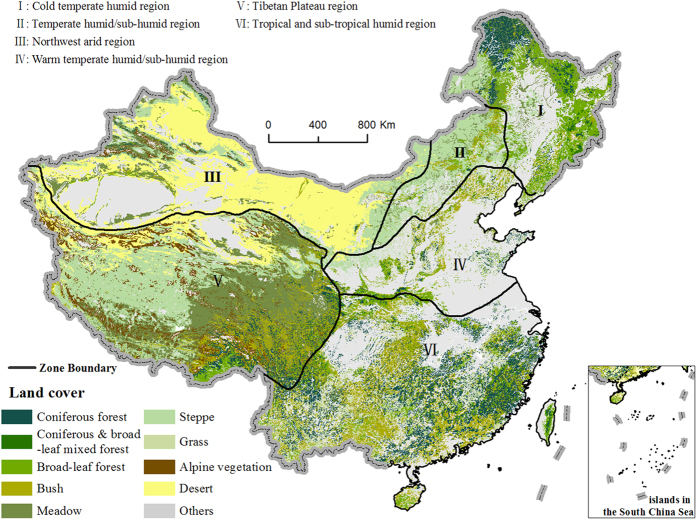
Figure 1. Main land cover types and six eco-regions in China.
The cultivated area, sandy desert and swamp are not included in the analysis and are classified as others in the map. The boundary of the regions is adopted from Zheng27. The land cover data were obtained from Compiling Committee of Chinese Vegetation (CCCV) with the scale of 1:1 000 00017. We generate the figure using ArcGIS software (http://www.arcgis.com).

