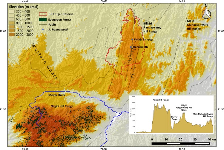
Fig 10. Elevation profile of hill ranges in and around BRT Tiger Reserve.
Faults within Biligiri Rangaswamy hill ranges are shown with dash lines. Maps and elevation profile were generated using QGIS® Pisa Ver. 2.10. Data was sourced from www.gadm.org for administrative boundary of India and Shuttle Radar Topography Mission (SRTM) 90 m database (http://srtm.csi.cgiar.org) for elevation.

