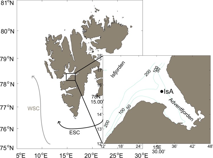
FIG 1.
Map of the IsA (Isfjorden-Adventfjorden) sampling station. (Left) The Svalbard archipelago with the large Isfjorden system at the west coast of Spitsbergen. The West Spitsbergen Current (WSC) and the East Spitsbergen Current (ESC) are indicated. (Right) Detailed map of Adventfjorden showing the position of the IsA sampling station. Depth contours (in meters) are from IBCAO (version 3.0) (101).

