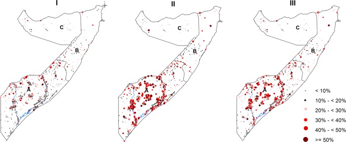
Figure 2.
Maps showing the observed prevalence of wasting (I), stunting (II) and underweight (II) by survey cluster between 2007 and 2010 in Somalia. The country is divided into three main zones: South Central (A), North East (B) and North West (C). Seventy eight clusters were sampled in the North West zone, 85 clusters in the North East zone and 903 clusters in the South Central zone. The country's two main rivers, Juba and Shebelle, are located in the South Central zone.

