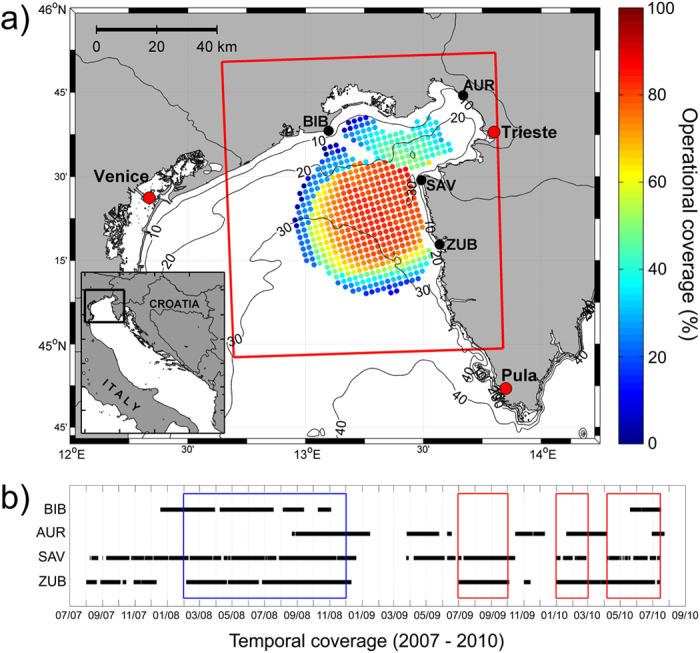
Figure 1.

(a) The domain of the SOM-based operational forecasting system in the northern Adriatic with marked HF radar stations (BIB – Bibione, AUR – Aurisina, SAV – Savudrija, ZUB – Zub). Operational coverage of hourly surface currents over the predefined Cartesian grid during testing periods is given in percent, while spatial coverage of the Aladin/HR model used for training and forecasting is denoted by the red rectangle. Operational coverage at the same Cartesian grid during testing period was higher than 60%. (b) HF radar operability between 2007 and 2010 with marked training (blue rectangle) and testing (red rectangles) periods. The figure has been created using MATLAB (www.mathworks.com) and CorelDRAW (www.corel.com) software.
