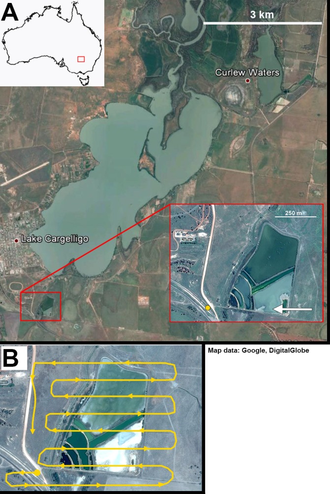
Figure 2. Lake Cargelligo, NSW, Australia.

The main lake is approximately 24 km2 and is managed to maintain water levels. The majority of waterfowl in the area congregate on the local sewage works (inset) where all UAV trials were carried out. (A) Yellow circle represents take-off site. White arrows represent approach angles for different flights. (B) One example of a flight path across the sewage works. Take-off site was away from the edge of the water and the target altitude was reached before crossing over water. As far as possible any banking or changes in altitude were carried out away from the water. Map data: Google, DigitalGlobe.
