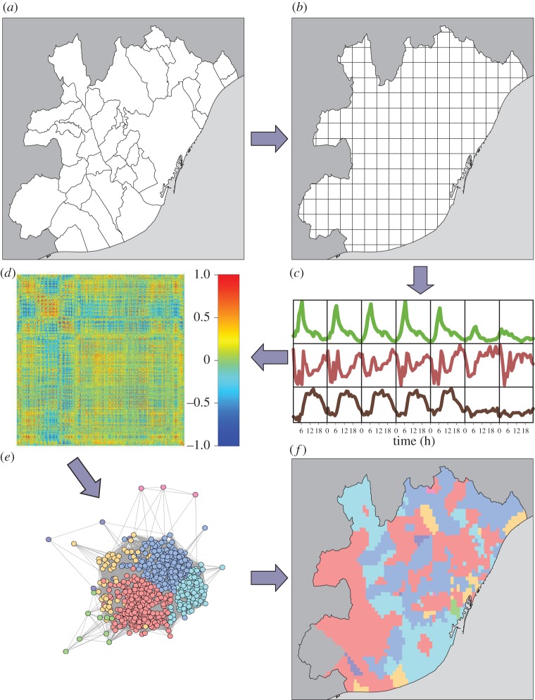
Figure 1.
Steps of the method to detect land use. (a,b) The urban area is divided in cells of equal area. (c) For each cell, we calculate an activity profile in terms of phone calls along time during the days of the week. (d) A Pearson correlation matrix between cell activities is computed. Then the matrix formed by correlations over a threshold value δ is used to define an undirected weighted network (e), which is clusterized using community detection techniques and the results plotted again on the city map (f).

