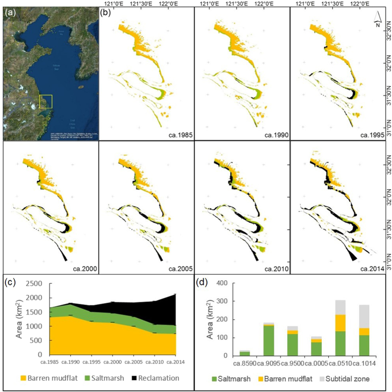
Figure 1. The spatial and temporal dynamics of tidal flats and land claim in the Yangtze Estuary.
Processed by ArcGIS 10.1 and ENVI 5.2 (a) Location of the Yangtze Estuary (yellow box) in relation to the Yellow Sea. Basemap Source: Esri, DigitalGlobe, GeoEye, i-cubed, Earthstar, Geographics, CNES/Airbus DS, USDA, USGA, AEX, Getmapping, Aerogrid, IGN, IGP, swisstopo, and the GIS User Community. Available at: http://services.arcgisonline.com/ArcGIS/rest/services/World_Imagery/MapServer. (b) The encroachment of land claim onto barren mudflat and saltmarsh during the past three decades. Same legend as (c). (c) Change in the areas of barren mudflat, saltmarsh, and claimed land. The estimated area of the three land classes and 95% confidence intervals. (d) Change in the area of enclosed habitats. ca. 8590: ca. 1985–1990, ca. 9095: ca. 1990–1995, ca. 9500: ca. 1995–2000, ca. 0005: ca. 2000–2005, ca. 0510: ca. 2005–2010, ca. 1014: ca. 2010–2014.

