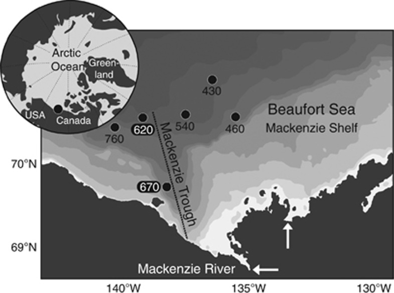
Figure 1.
Location of the Beaufort Sea stations sampled in August 2009. White arrows indicate the Mackenzie River main outlets. The Mackenzie Trough is marked with a dashed line and the shaded contours denotes the bathymetry retrieved from the International Bathymetric Chart of the Arctic Ocean (IBCAO v.3; Jakobsson et al., 2012). Station latitude and longitude coordinates are: St 430 (71.217,−136.720); St 460 (70.678,−136.047); St 540 (70.751,−137.892); St 620 (70.680,−139.627); St 670 (69.798,−138.441); St 760 (70.554,−140.798).

