
Fig 1. Sampling of RABV samples.
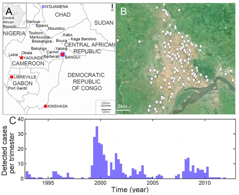
Map of the Central African Republic and neighbouring countries (a) showing the location (red points and squares) of the 162 isolates of RABV analyzed in this study. The cities in red indicate the presence of RABV belonging to the Africa 1 clade. Cities in blue represent those where RABV belonging to the Africa 2 clade were found. In Bangui, both clades were identified. Detailed map of Bangui (b), showing the location of the 122 samples analyzed in the context of the landscape. Number of specimens positive for rabies (c) by trimester during sentinel surveillance, January 1993 to March 2012.