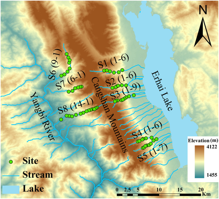
Figure 1. Map of the study area and the distribution of sampling sites in the Cangshan Erhai National Nature Reserve, Yunnan Province, Southwestern China.

Green dots represent sampling sites (S1–1 represents the site most upstream in stream 1, and S1–6 represents the site most downstream in stream 1); blue lines and polygon depict the streams and the Erhai Lake. The map is based on a digital elevation model at 30 m resolution and created using ArcGIS 10.0 software (http://www.esri.com/software/arcgis).
