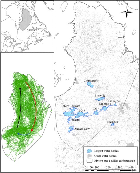
Fig. 1.

Study area in Northern Québec showing the range of the Rivière-aux-Feuilles caribou herd. We delineated the range using a 100 % minimum convex polygon encompassing caribou locations from 2007 to 2014. The largest water bodies used to study caribou responses to ice and water (as well as Lake Nichicun, see Additional file 3) appear in blue. All other water bodies in the province appear in light grey. Inserts show the location of our study area (top-left) and the steps performed by caribou during this study (bottom-left). Overlaid over observed steps (green lines) are the approximate trajectories of the fall migrations (red arrow), winter displacements (blue arrow), and spring migrations (black arrow) performed by caribou
