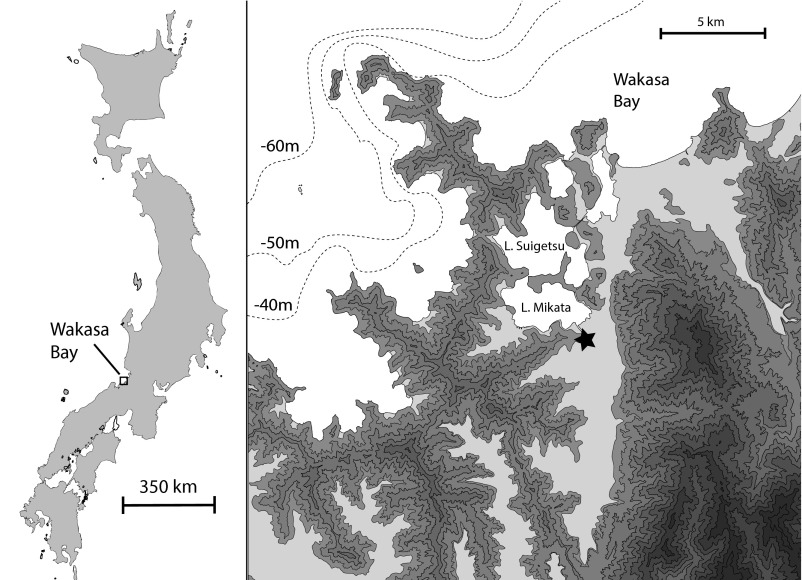
Fig. 1.
Location of the Torihama site (starred) on Wakasa Bay. Dotted contours indicate the bathymetry relative to present mean sea level. The coastline corresponding to the Incipient period was between approximately 65–50 m below present-day sea level (14). Topography is shaded by 50-m increments. Image courtesy of Hideaki Kojima (Wakasa Mikata Jōmon Museum).

