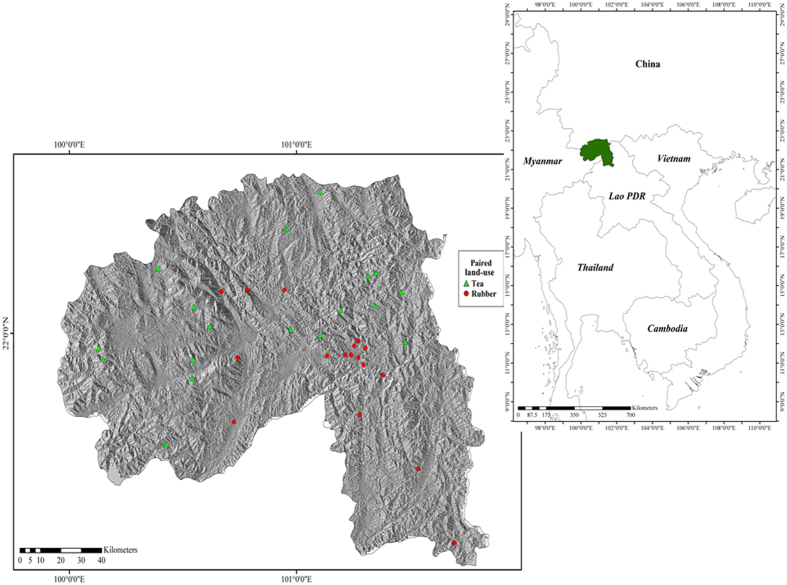
Figure 5. Location of Xishuangbanna (XSBN) in Yunnan province, China and in Southeast Asia (right; green) and paired sample sites where arthropods were collected (left).
The green triangles represent forest-tea paired sites and the red circles represent forest-rubber paired sites. The regional map (China, Cambodia, Lao PDR, Myanmar, Thailand and Vietnam) was generated using the TM_world_borders_3 dataset freely available from the thematic mapping website (http://thematicmapping.org/downloads/world_borders.php). The prefecture (XSBN) map was generated using the freely available level three (provincial) maps from Divagis spatial data (http://www.diva-gis.org/; Hijmans, R. J., L. Guarino, C. Bussink, P. Mathur, M. Cruz, I. Barrentes, and E. Rojas. 2004. DIVA-GIS. Version. 5.0. A geographic information system for the analysis of species distribution data). Background data shows the slope aspect, generated from the Shuttle Radar Topography Mission (SRTM) 1 Arc-Second Global using the “aspect” tool in ArcMap 10.1 (ESRI 2015. ArcGIS Desktop: Release 10.1. Redlands, CA: Environmental Systems Research Institute; http://desktop.arcgis.com/en/arcmap/). Points were downloaded from a hand-held GPS (GPSMAP® 62s | Garmin) before being digitized and uploaded as a shapefile.

