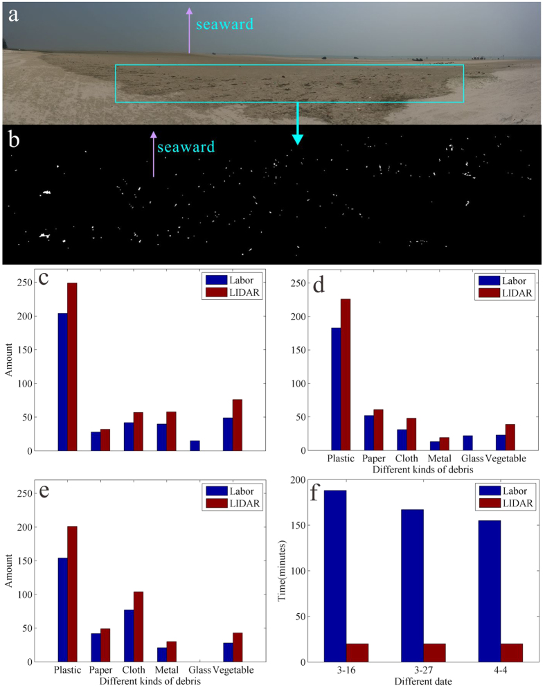
Figure 5. Validation of the semi-automatic recognition method for marine debris on Beihai beach.
(a) Photo of the beach on March 16, 2015. The box represents the study area where the statistical data of the debris were manually obtained. (b) Distribution of debris identified by LIDAR in the study area. (c–e) Comparisons of the types and quantities of debris for the manual and LIDAR methods. (f) Comparison of the time consumed for the manual and LIDAR methods. The figure was created in RiSCAN PRO 1.7.8 and CorelDRAW Graphics Suite X5.

