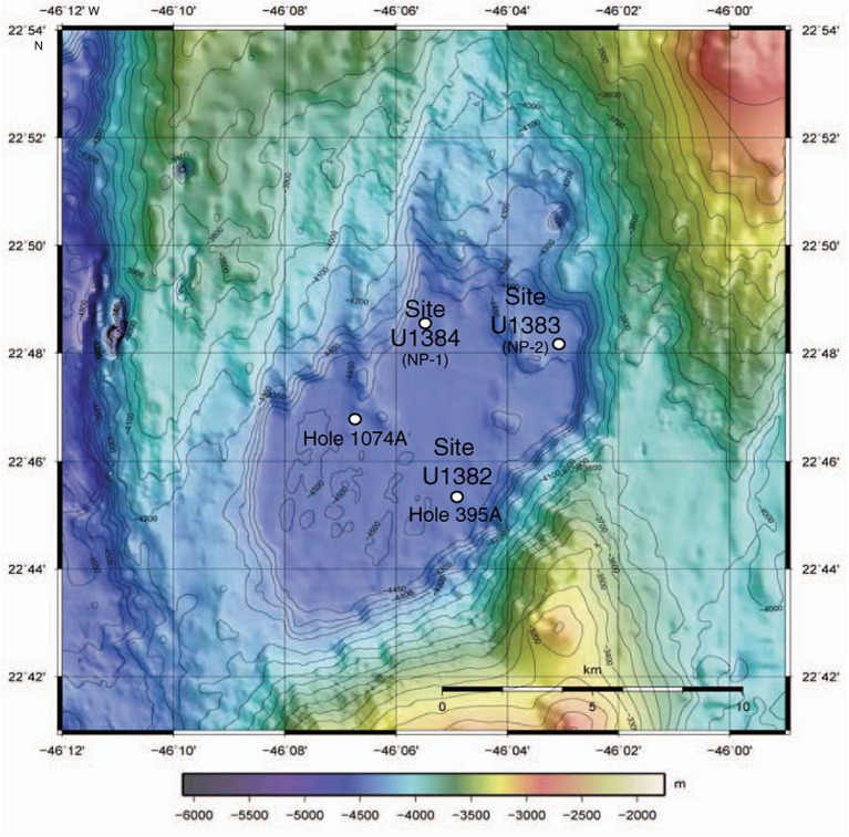
FIGURE 1.
Bathymetric map of North Pond in the Atlantic Ocean, showing drill sites (from Expedition 336 Scientists, 2012). Isolates in this paper are from Site U1382, Hole U1382B and enrichments were also started from Hole U1382A, Site U1383 (Holes U1383C and U1383E) and Site U1384 (Hole 1384A; Supplementary Table S1). Sites from IODP Expedition 336 are shown (Site #, NP #), as are holes previously drilled in the area (DSDP Hole 395A, ODP Hole 1074A).

