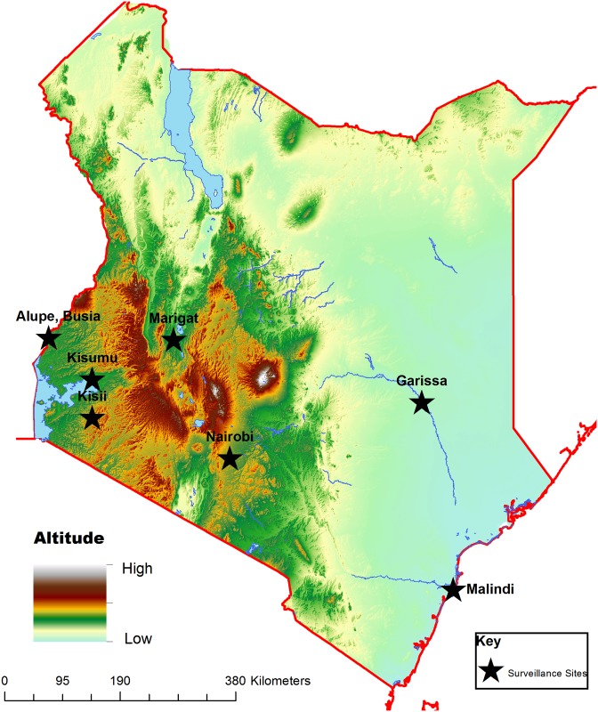
Fig 1. Map of Kenya showing the locations of various surveillance hospitals.
Lake Victoria basin: Kisumu District Hospital, New Nyanza Provincial Hospital and Alupe District Hospital. Kisii highland: Kisii District Hospital. Semi-arid: Marigat District Hospital on floor of the Rift Valley. Arid north eastern Kenya: Garissa District Hospital and Iftin sub-District Hospital. Coast of Indian Ocean: Malindi District Hospital. The map was generated in house using the ArcView®10.0 application (Environmental Systems Research Institute, Redlands, CA, USA). Elevation base data was downloaded from the world resources institute website (http://www.wri.org/).

