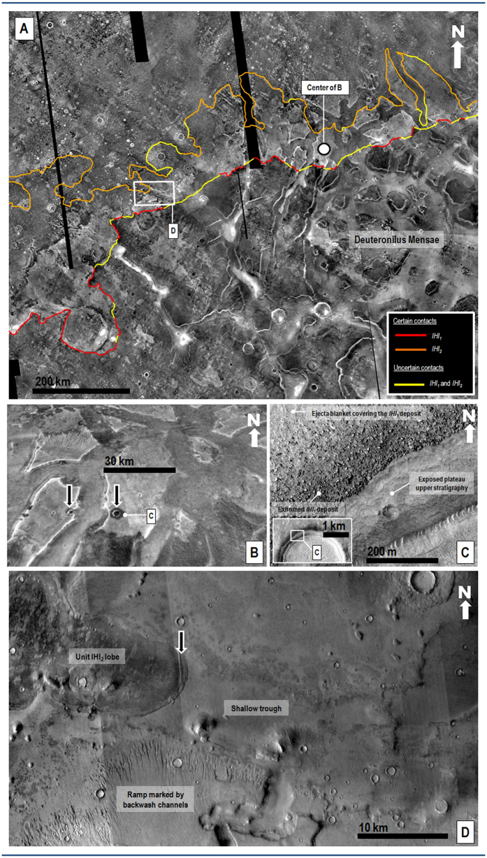
Figure 2.
(A)View of highland surfaces along the highland-lowland boundary in northwestern Arabia Terra, which are embayed by the upper reaches of members lHl1 and lHl2. The red (lHl1) and orange (lHl2) lines show contact sections mapped as certain. The yellow lines are zones where the contacts are obscured due to localized resurfacing or mantling. Out of the total 4124 km length of these mapped contacts, 76% is certain and 23% is uncertain. Part of THEMIS night-time infrared image mosaic (100 m/pixel) centered at 43°26′N, 12°29′E. Credit: Christensen et al.32. (B) Perspective close-up view on a system of mesas, which are partly covered by the upper reaches of member lHl1. These deposits consist of thermally bright materials that pass upland-wards into thermally dark surfaces. The black arrows show locations where the thermally dark materials are exhumed from beneath the thermally bright materials by impact craters. Center location indicated by dot in panel A. Part of THEMIS night-time infrared mosaic (100 m/pixel) centered at 45°45′N, 16°41′E. Credit: Christensen et al.32. (C) Visible light close-up view on one of the craters identified in panel (B). The impact crater’s inner wall shows the boulder deposit (member lHl1) overlying an exhumed non-bouldery upper stratigraphy. The boulder deposit is also locally covered by a non-bouldery ejecta blanket. The inset shows the view’s location along the crater’s northern margin. Part of HiRISE image ESP_017355_2260 centered at 45.82°N 16.47°E (50 cm/pixel). Credit: NASA/JPL/University of Arizona. (D) Close-up view of northeast Deuteronilus Mensae showing a low-angle ramp marked by backwash channels (part of member lHl1), which is cut by a shallow trough. A lobe of member lHl2 can be observed to run up the trough’s surface. The black arrow identifies a marginal compressional fold. Location is shown in panel (A). Part of a CTX mosaic centered at 44°49′N, 11°10′E. Credit: NASA/JPL. The license terms can be found on the following link: pds-imaging.jpl.nasa.gov/portal/mro_mission.html. We produced the mosaics and maps in this figure using Esri’s ArcGIS® 10.3 software (http://www.esri.com/software/arcgis).

