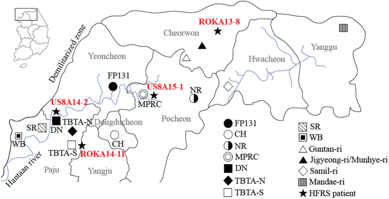
Figure 4. A geographic map of the most likely site of HFRS patients with HTNV infection.
The map shows military training sites and places where rodent surveillance was conducted. The areas are near the demilitarized zone, northern Gyeonggi and Gangwon provinces, Republic of Korea; Paju, Yangju, Dongducheon, Yeoncheon, and Pocheon are included in Gyeonggi province. Cheorwon, Hwacheon, and Yanggu are included in Gangwon province. Based on the phylogeographic analysis, most likely sites where four HFRS patients acquired HTNV infections are indicated; ROKA13-8, Cheorwon; ROKA14-11, TBTA-S; US8A14-2, DN; US8A15-1, Pocheon (FP 131, Fire Point 131; CH, Camp Hovey; NR, Nightmare Range; MPRC, Rodriguez Multi-Purpose Range Complex; DN, Dagmar North; TBTA-N, Twin Bridge Training Area North; TBTA-S, Twin Bridge Training Area South; SR, Story Range; WB, Warrior Base). (We used Adobe Illustrator CS6 (http://www.adobe.com/products/illustrator.html) to create the map).

