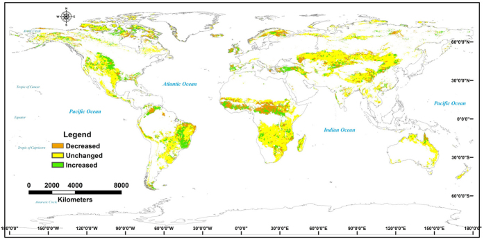
Figure 4. The changes of determination coefficient (R2) of correlation between annual mean NDVI and potential NPP in global grasslands after 2000.
The spatial change maps were developed from the spatial correlation and calculation techniques through the application of ERDAS IMAGINE 8.4 (http://www.hexagongeospatial.com/products/producer-suite/erdas-imagine) and ARCGIS 10 (http://www.esri.com/software/arcgis/arcgis-for-desktop).

