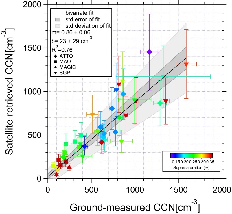
Fig. 3.
The relationship between satellite-retrieved NCCN and S at cloud base, and the ground-based instrument measurements of NCCN at the same S. The slope and intercept of the best fit line are given in the key by m and b, respectively. The validation data are collected from the DOE/ASR sites on the SGP in Oklahoma and GOAmazon near Manaus, and over the northeast Pacific (MAGIC). In addition, data are obtained from the ATTO. The location is denoted by the marker shape, and S is shown by the color.

