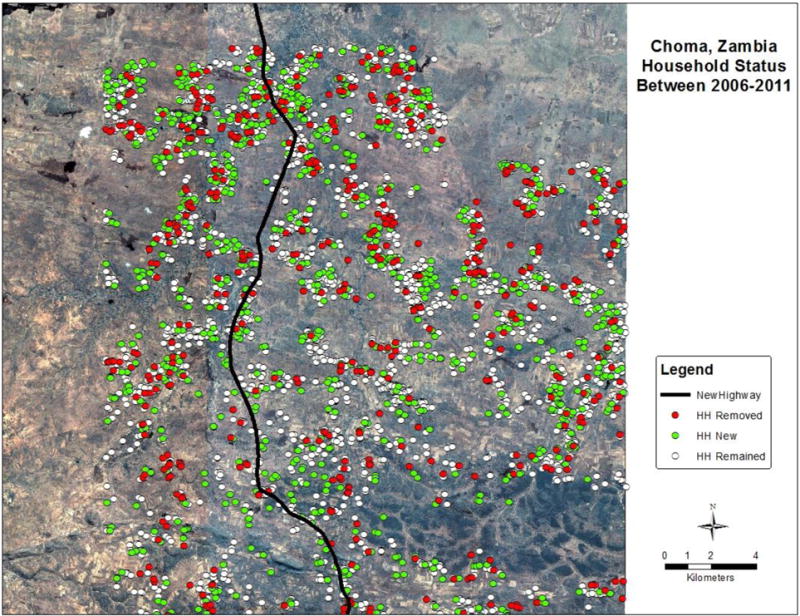
Figure 1. Change in households between the enumerated 2006 and 2011 satellite images for the study area in Southern Province, Zambia.

The enumerated households in the 2006 image include the remaining and removed structures (red and white labels, respectively) and the enumerated households in the 2011 image include the remained and newly added structures (white and green labels, respectively).
