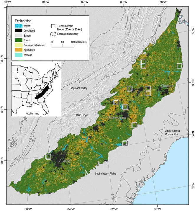
Fig. 1.

The Piedmont ecoregion from the 1992 National Land Cover Dataset (Vogelmann et al. [39]) modified to the ten land use and land cover classes of the USGS Land Cover Trends Project. Square boxes indicate the eleven 20 km2 land cover change sampling blocks at 60 m spatial resolution
