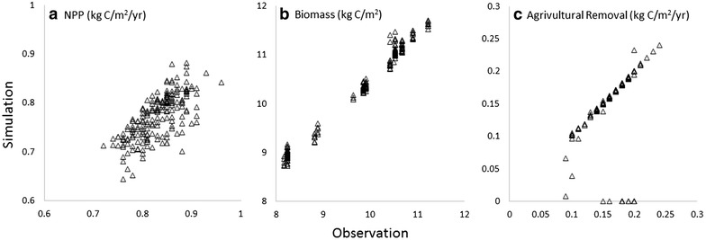
Fig. 9.

IBIS model validation against remote sensing and field survey data at the county level. a Simulated forest NPP against MODIS NPP product; b Simulated 100 year forest tree biomass against FIA based COLE database; c Simulated agricultural harvest carbon removal (grain + hay + straw) against USDA NASS crop harvest data. Each data point represents a county in the Piedmont ecoregion (total 198 counties)
